Get your FREE personal EAP offer today and step into the future of agricultural monitoring!
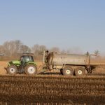
Constellr is using cutting-edge beyond-visual imaging technology to revolutionize the way we assess crucial aspects of our planet’s health. With temperature readings, they are able to monitor vegetation, soil health, and derive insights on water and carbon, as well as monitor industrial activities with an unprecedented level of accuracy.
In the quest to ensure food security on Earth, one of the most innovative approaches involves measuring Land Surface Temperature (LST) from space. LST represents the radiative skin temperature of the land, which is an aggregated temperature of all surface components within the sensor’s field of view, including soil, vegetation, and water. It’s important to note that LST is not the same as air temperature measured using a sheltered thermometer, nor is it the ground-surface temperature at a specific depth.
How is LST Measured from Space?
To achieve high accuracy in measuring LST from space, several advanced technologies and methodologies are employed:
- High Accuracy: Measurements are accurate to within less than 2.0 K.
- Cryo-cooled Detector: Ensures the highest image quality.
- High Spatial Native Resolution (GSD): 30m for thermal, and 5m for visible and near-infrared.
- Rapid Data Delivery: Data is delivered within 12 hours from recording.
- Imaging Capacity: Each satellite can image up to 1,000,000 km² per day.
- High Temporal Resolution: Provides global coverage with a daily revisit time.
- High Precision Thermal Infrared (TIR) Camera: Offers very high temperature sensitivity of 0.07K at 295K.
Real-World Application
On September 10th, 2023, at 10:21 am local time, air temperatures ranged from 27 to 30 degrees Celsius at a local weather station. However, LST images revealed a much broader range of temperatures, from 32 to 55 degrees Celsius across different fields. This discrepancy highlights the importance of LST measurements in understanding and managing the microclimates within agricultural areas.
Early Access Program (EAP)
The future of agricultural monitoring with the Early Access Program (EAP) from Constellr.
This program offers:
- Guaranteed Superior Technical Performance: Including spatial resolution, accuracy, sensitivity, revisit time, and latency.
- Assured Access: To Constellr’s data, competence, and technology, initially available to a limited number of customers.
- Secure Terms and Conditions: For up to 5 years.
- Flexible Commitment Options: From legally binding and pre-paid to more flexible arrangements.
Get your personal EAP offer today and step into the future of agricultural monitoring!
For more information, visit Constellr.